.png?width=2347&height=620&name=outlined%20ag%20marketing%20logo%20black%20(1).png)

As we get into the back end of July, summer temperatures are rising and severe weather is becoming more common. And the heat is not likely to go away.
Recent precipitation has improved soil moisture levels in parts of the Midwest and East, helping to mitigate the impact of upcoming heat.
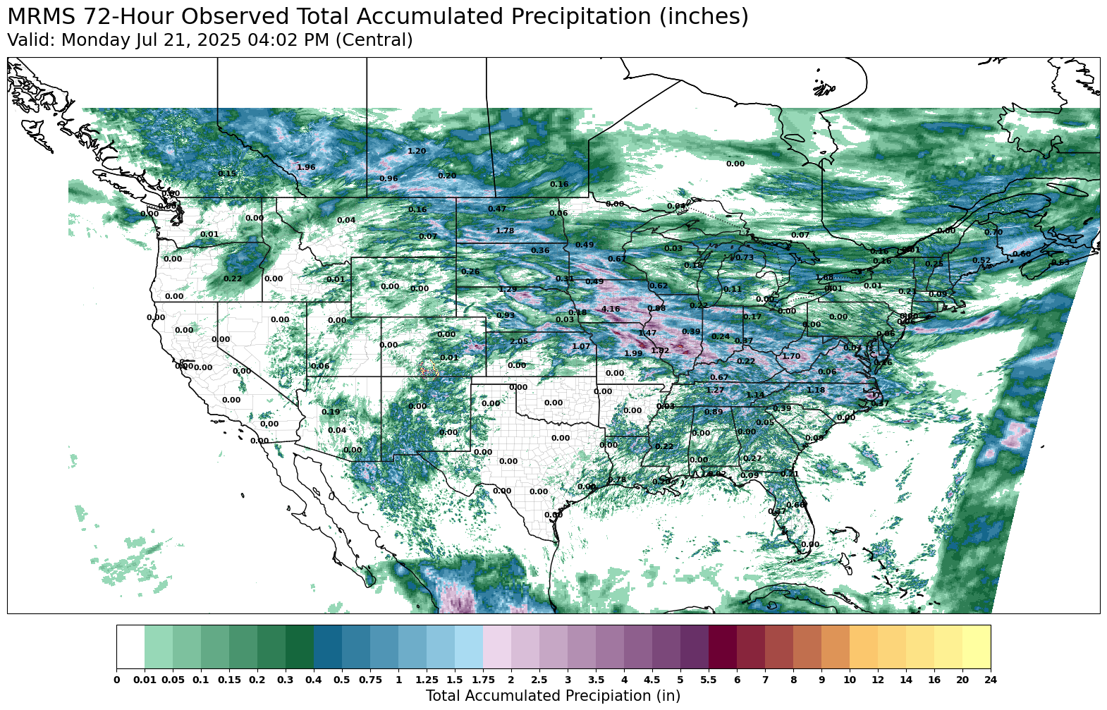
Central Texas and Oklahoma missed out on rain last week, and are now poised to bear the brunt of the heat in the next few days with the highest risk for flash drought. Temperatures will be high across much of the center of the country, with heat indexes over 110 degrees because of high humidity in Iowa, Illinois and Indiana.
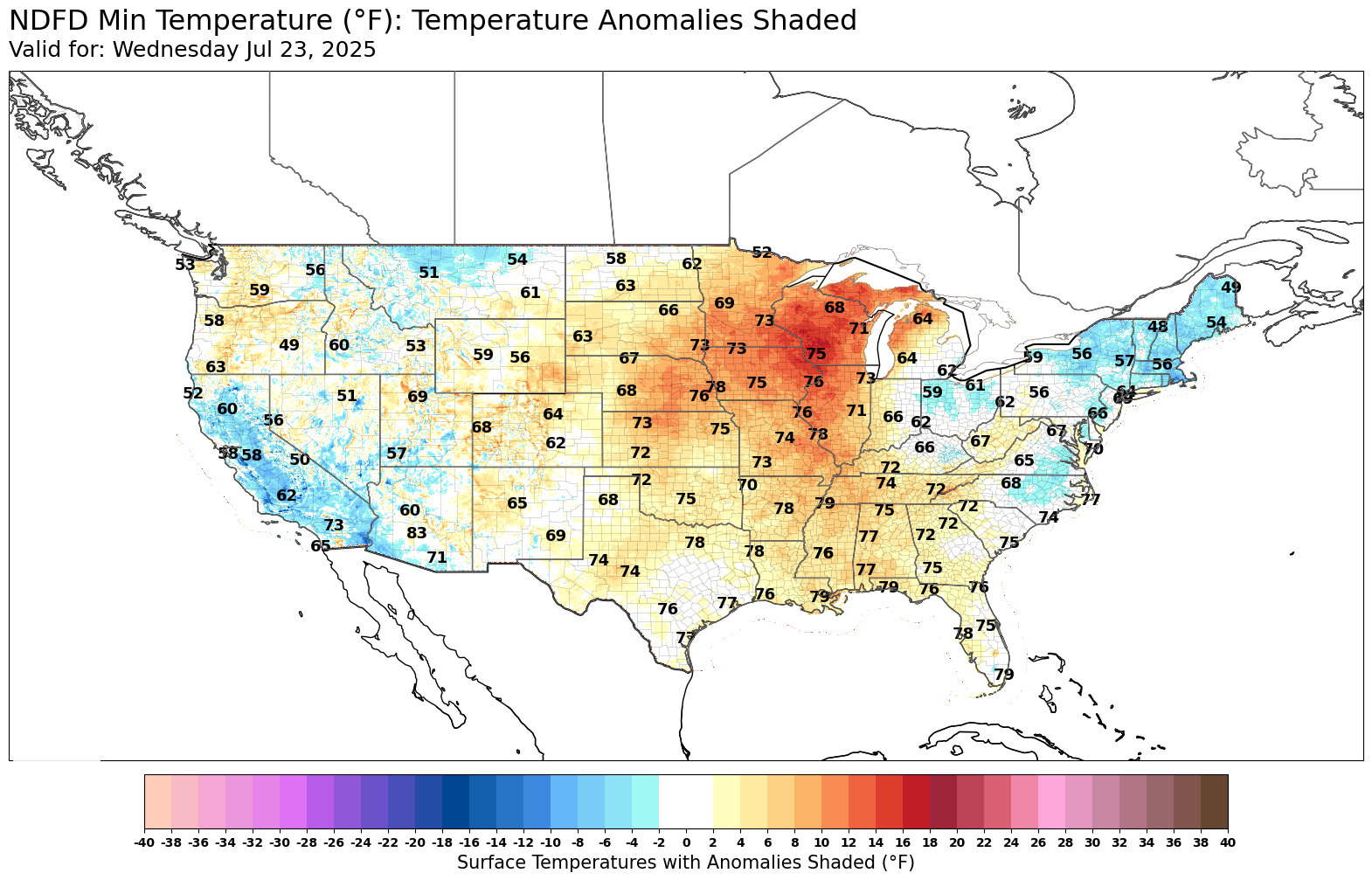
It’s not just the peak temperatures that are worrisome. Minimum temperatures this week are high across much of the country, with temps in the Minnesota-Wisconsin-Iowa area getting close to record-breaking on Wednesday morning.
High temperatures alongside high overnight temperatures have the potential to hurt crop yield. During a recent forecast interview, Trader PhD Ag Consultant Nick Lawrence and Nutrien Ag Solutions’ Eric Snodgrass discussed that the areas most at risk for the high temperatures to linger are already beginning or will begin harvest soon to harvest, slightly reducing the risk of adverse effects.
The heat in the central U.S. looks like it will be accompanied by severe weather in the upper Midwest and the Great Lakes region, areas that have already seen a lot of precipitation with river levels high.
What remains to be seen is how long these temperatures and precipitation patterns hold. If they stay too long they have the potential to hurt yields, but at present they don’t appear to be too threatening over the long term. July is the hottest month of the year, and it’s looking to be the same way this year.